Colorado Unit 36 Hunting Information

Home » Hunting Informations » Colorado Units Hunting Information » Colorado Unit 36 Hunting Information

Overview of CO GMU 36 Hunting Facts

Planted in Eagle County in the mid-northwestern territory of Colorado, Unit 36 possesses all of the elements that keep hunters coming back every year! First of all, there is a series of rivers and creeks that weave throughout, providing a necessary gathering area for wildlife. The Piney River is the largest water source in Unit 36. Secondly, the elk and antelope tags are OTC and easily obtained. Third, of the approximate 177,000 acres, 84% of the unit is public land, allowing for the multitude of hunters that congregate to this unit every year to have more space to spread out. The hunting pressure is high in this unit, mostly credited to the OTC elk and antelope tags. The proximity of the Cross (Meadow Mountain) Ranger District Office in Minturn allows for hunting information for Colorado Unit 36 to be easily obtainable. For more Colorado Unit 36 hunting information, check out the Info for Cities Near Unit 36 section on the right.

Table of Contents

CO Unit 36 Species Hunting Info

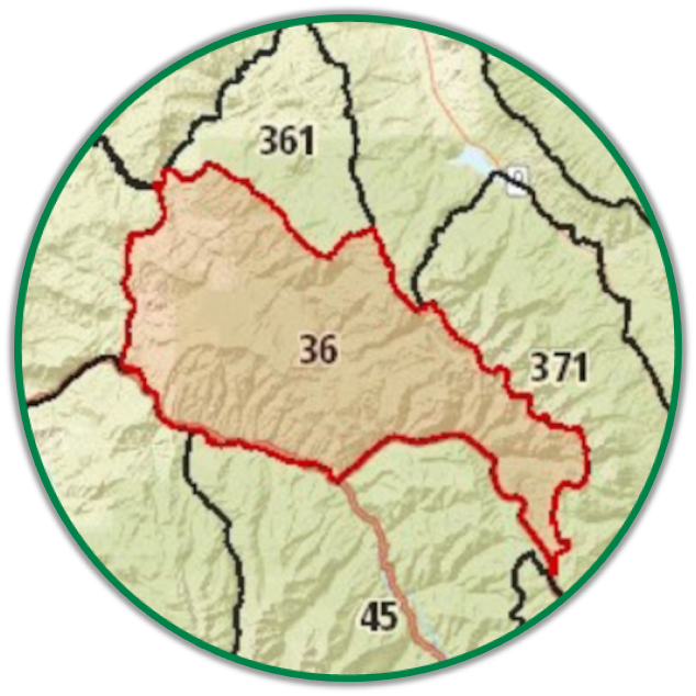
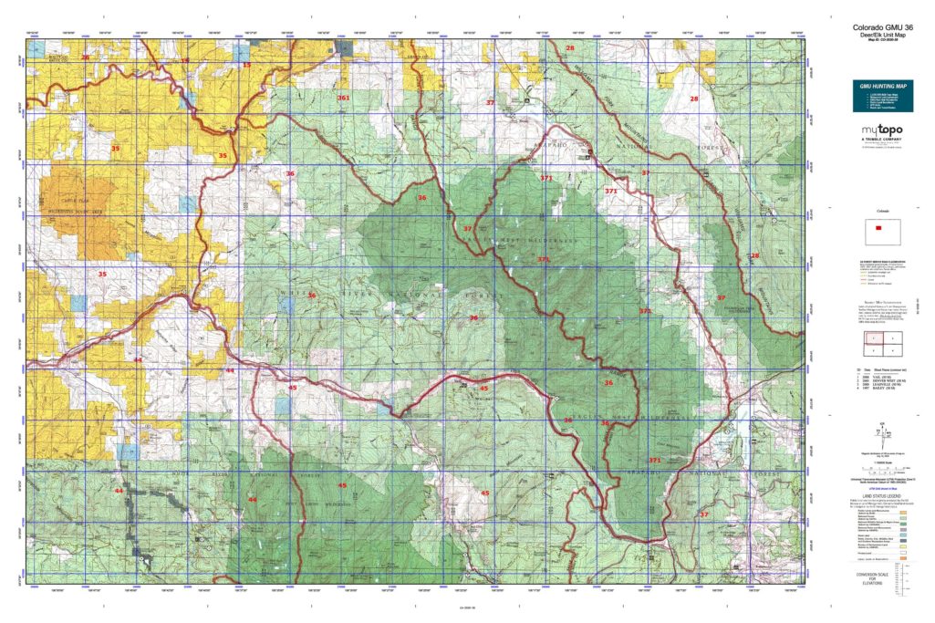
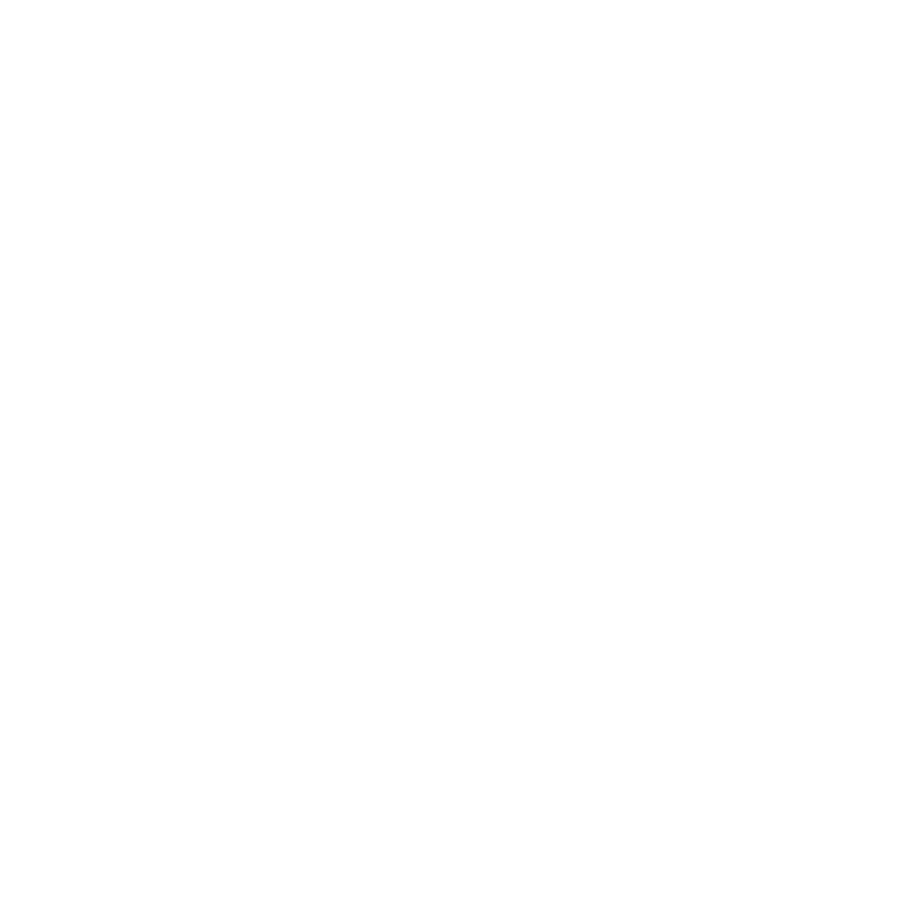
INFO: Mule Deer Hunting in Colorado Unit 36
Mule deer tags in unit 36 are also available in Units 36, 45, and 361 for all seasons. There is a limited draw for mule deer tags, but the waiting time is nothing like other units. Some tags are pulled after just one preference point purchase! That being said, there is substantial hunting pressure in this unit, especially with the availability of OTC elk tags for certain seasons. A good idea is to purchase an elk tag to go along with you on your mule deer hunt, just in case a big bull shows up.

SUCCESS RATES for Mule Deer Hunting in Colorado Unit 36
5 Year Estimated Average for Deer
Archery 12%
Muzzle Loader 25%
Early Rifle 50%
2nd Rifle 25%
3rd Rifle 35%
4th Rifle 45%
Mule Deer TROPHY QUALITY for Unit 36 Colorado
Average Quality 140″ – 160″
Trophy Potential 160″+
Buck to Doe Ratio 30:100
Colorado Unit 36 Mule Deer Hunting FORUM Coming Soon!

INFO: Elk Hunting in Colorado Unit 36
As previously mentioned, elk tags in Colorado Unit 36 are sold over-the-counter for archery, second rifle season, and third rifle season. For the muzzleloader and first rifle season, there is a limited draw. The hunting pressure can be felt, especially if you’re hunting off the trails and roads. The hunters that hike back into the thick, remote areas will have an advantage over others. A successful method of ensuring your place in the remote areas to hunt is to set up a spike camp. However, you must know how to not be detected by wildlife. Keep your noise level at a minimum when you’re at the camp and do not burn fires. If this is doable for you, then this method will save you some time and energy hiking miles and miles to and from a large camp.

SUCCESS RATES for Elk Hunting in Colorado Unit 36
5 Year Estimated Average for Elk
Archery 8%
Muzzle Loader 10%
1st Rifle 22%
2nd Rifle 15%
3rd Rifle 10%
4th Rifle 22%
Elk TROPHY QUALITY for Unit 36 Colorado
Average Quality 270″ – 310″
Trophy Potential 320″+
Bull to Cow Ratio 28:100
Colorado Unit 36 Elk Hunting FORUM Coming Soon!

INFO: Antelope Hunting in Colorado Unit 36
Hunting antelope in Unit 36 Colorado is a perfectly feasible opportunity since the archery tags are sold OTC. Whether you’re hunting solely antelope or adding on a tag to complement an elk or mule deer hunt, Unit 36 can bring success. Aside from dense evergreen forests, Unit 36 does contain some grasslands and shrubbery, perfect for pronghorn.

SUCCESS RATES for Antelope Hunting in Colorado Unit 36
5 Year Estimated Average for Antelope
Archery 50%
Colorado Unit 36 Antelope Hunting FORUM Coming Soon!

Unit 36 Hunting Information Video

iconinfo.png

Info Cities Near CO GMU 36

lay-of-the-land-icon-.gif

Colorado Unit 36 Topo Map

Total Acreage: 175,000 over 274 square miles

Total Public Land: 150,000 acres or 84%

Land Ownership Mix: 16% Private; 84% Public; USFS: 136,640 acres; USFS Wilderness: 52,416 acres; BLM: 6,976 acres

Species: Black Bear, Elk, Mule Deer, Moose, Pronghorn

Elevation Variances: 7,170 ft. to 13,370 ft.

Terrain Difficulty Overall: Moderate

Land Coverage/Vegetation: 33.5% evergreen forest, 21.1% deciduous forest, 20.3% shrub/scrub, 12.3% grassland/herbaceous and 4.1% barren land (rock/sand/clay)

Unit 36 Boundaries: (Eagle, Grand County Colorado) bounded on North by Colorado River from State Bridge to Inspiration Pt; on East by Gore Range Divide; on South from Gore Range Divide to Dowd Junction by Interstate70 and from Dowd Junction to Wolcott by the Eagle River; on West by Colorado 131

map-icon.png

Lay of the Land in CO Unit 36

lay-of-the-land-icon-.gif

Terrain in GMU 36 CO

The terrain in Colorado GMU 36 is a blend of high elevations and deep canyons with some heavily forested areas. However, this is an advantage for the determined hunter that feels confident in his physical capabilities. There are pockets and remote areas that other hunters will shy away from due to the inclines or thick foliage. However, if you can trudge your way past these obstacles, your remote location will push you into unpressured wildlife or hiding spots that the wildlife feels pressured into.
vegetation-icon.png

Vegetation in GMU Unit 36 CO

Vegetation in Colorado Unit 36 is a mix of croplands, shrublands, forests, and riparian groups. The higher elevations are where you will find a variety of spruces, aspens, and firs. The middle elevations are home to pinyon pines and juniper. The very low elevations are full of hayfields and shrublands populated with sagebrush and wheatgrass. Riparian plants live along creeks and rivers. All of the above-mentioned plants offer feed and nutrition for the surrounding wildlife. Depending on the time of the year, deer and elk can be found grazing and using the vegetation for cover. Once the snow begins to fall, they will switch their diet from the higher elevations down to the middle and lower elevations.
map-directions-icons.png

Access Points in CO GMU 36

Unit 36 contains 219 miles of trails and a network of small roads connecting throughout. IH-70 runs along the southern border of the unit with SH 131 on the west. The series of rivers and creeks create a water highway throughout the unit, offering opportunities for water access to the hunting areas.