Colorado Unit 61 Hunting Information

Home » Hunting Informations » Colorado Units Hunting Information » Colorado Unit 61 Hunting Information

Overview of CO GMU 61 Hunting Facts

When describing the best hunting units in Colorado, no discussion is complete without mention of the legendary Unit 61. Located in southwestern Colorado in Montrose, San Miguel and Mesa counties, Unit 61 is located on the Uncompahgre Plateau and within the Uncompahgre National Forest. The dense population of elk and mule deer, the trophy sized big game, along with the exclusivity of holding a Unit 61 tag, makes this unit one of the most sought after tags in the state of Colorado. For more Colorado Unit 61 hunting information, check out the Info for Cities Near Unit 61 section on the right.

Table of Contents

CO Unit 61 Species Hunting Info

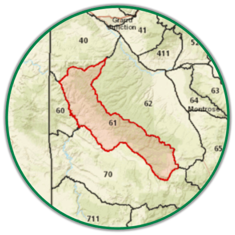
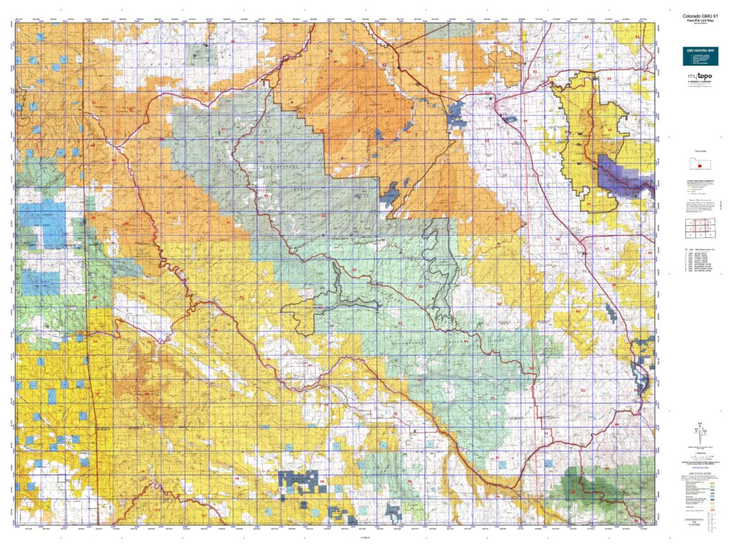
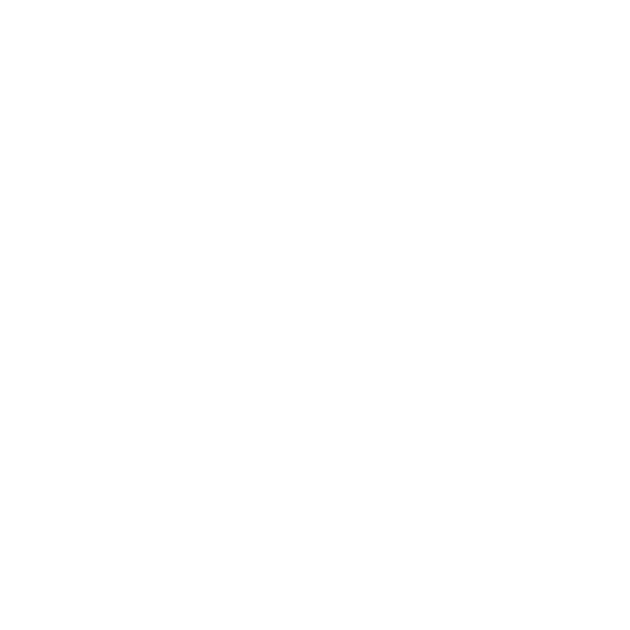
INFO: Mule Deer Hunting in Colorado Unit 61
The mule deer population has stumbled a little bit the past few years, but it is on the mend. The deer tags are extremely limited in this unit, which helps keep the numbers growing and the hunting pressure down. This, in turn, will lead to a larger population but also to a higher percentage of mature bucks. Unit 61, being located in the southern portion of the state, is known to have warm temperatures in the archery and muzzleloader seasons. Therefore, these early season hunts would best be strategized to include wallowing sites and water sources. In addition to keeping cool by water, deer will also retreat to thicker cover vegetation to escape the heat. As the temperatures cool, rifle season will begin and the deer will be moving from the highlands into the lower lying areas. Each season will have its own set of challenges, but having an understanding of the deer and the area will dramatically increase your chances of taking a huge buck in unit 61.

SUCCESS RATES for Mule Deer Hunting in Colorado Unit 61
5 Year Estimated Average for Deer
Archery 20%
Muzzle Loader 45%
2nd Rifle 50%
3rd Rifle 60%

Mule Deer TROPHY QUALITY for Unit 61 Colorado
Average Quality 160″ – 180″
Trophy Potential 180″+
Buck to Doe Ratio 31:100
Colorado Unit 61 Mule Deer Hunting FORUM Coming Soon!

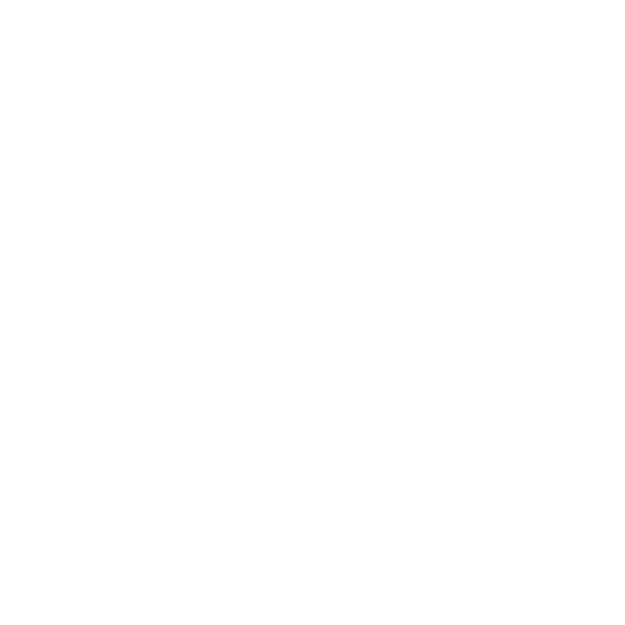
INFO: Elk Hunting in Colorado Unit 61
Colorado Unit 61 is undoubtedly, one of the state’s most reputable and esteemed trophy bull units. Due to the elevated bull to cow ratio, the rut is longer-lasting and more exciting than other Colorado GMU’s. The elk herd is flourishing in this unit with increasing numbers every year. Unit 61 is a stand-alone unit for all tags in all seasons. Archery and the early season are all valid for hunting elk of either sex. Unit 61 is also friendly to those hunters that choose to hunt closer to camp with numerous accounts of big kills being scored after less than a mile of travel, especially during the rut when bugling can be heard without any scout work. It is not uncommon to hear and see 5 to 10 screaming bulls in a single day hunting. The elk are definitely not shy here.

SUCCESS RATES for Elk Hunting in Colorado Unit 61
5 Year Estimated Average for Elk
Archery 40%
Muzzle Loader 60%
1st Rifle 60%
2nd Rifle 50%
3rd Rifle 60%
4th Rifle 65%
Elk TROPHY QUALITY for Unit 61 Colorado
Average Quality 300″ – 340″
Trophy Potential 350″+
Bull to Cow Ratio 19:100
Colorado Unit 61 Elk Hunting FORUM Coming Soon!

INFO: Antelope Hunting in Colorado Unit 61
With an OTC archery antelope tag, a hunter can take on a new and adventurous challenge. Antelope are very aware of their surroundings, so be sure to have a plan. The semi-desert ecosystem coupled with water sources in the proximity create the perfect environment for pronghorn. The flat terrain with vegetative cover provides cover and food sources for the herds. The water sources create a location for the herds to congregate into larger groups, especially during the warmer months.

Overview of CO GMU 61 Hunting Facts

iconinfo.png

Info for Cities Near CO GMU 61

lay-of-the-land-icon-.gif

Colorado Unit 61 Topo Map

Total Acreage: 590,000 acres over 922 square miles

Total Public Land: 500,000 acres or 85%

Land Ownership Mix: 15% Private; 85% Public; USFS: 289,920 acres; BLM: 210,816 acres

Species: Black Bear, Elk, Mule Deer, Moose, Pronghorn

Elevation Variances: 4,600 ft. – 10,000 ft.

Terrain Difficulty Overall: Mild to Moderate

Land Coverage/Vegetation: 45% evergreen forest, 4% grassland, 19% shrub/scrub and 26% deciduous forest

Unit 61 Boundaries: (Mesa, Montrose, Ouray, San Miguel County Colorado) bounded on North by Colorado 141; on East by United States Forest Service Roads 402 (Divide Road), 517 (South Divide Road), and Dave Wood Road; on South by Colorado 62; on West by San Miguel and Dolores rivers

map-icon.png

Lay of the Land in Unit 61

lay-of-the-land-icon-.gif

Terrain in GMU 61 CO

The terrain of Colorado unit 61 ranges from mild to moderate, allowing travel to be tolerable for a wide range of hunters with assorted physical capabilities. The Uncompahgre Plateau is among a range of flat mesas with large canyons at the base. In addition to river bottoms, slopes and inclines, there are flat areas more relevant to a desert environment.
vegetation-icon.png

Vegetation in Unit 61 CO

In the high mountains of Unit 61, a few of the foliage types include Rocky Mountain Maple, spruces, firs and aspens. In the middle to lower elevations, vegetation consists of pinyon-juniper woodlands, elderberry, aspens and floral species such as yarrow. The lower level areas are occupied by desert shrubbery including single-leaf ash, shadbush, yucca and sagebrush. Along the river bottoms, there is plant life of the riparian variety such as cottonwoods, milkweed and thimbleberries. Deer and elk forage on a large majority of the vegetation available to them. When plant growth is sparse, the wildlife will migrate from the highlands and begin their winter diet by feeding on the low elevation herbage.
map-directions-icons.png

Access Points in CO GMU 61

Unit 61 is bounded by the San Miguel River from the southeastern corner to the southwestern corner of the unit, where it meets the Dolores River. The Dolores River then winds along the western boundary line until it reaches Hwy 141, which then runs along the northern border. Uncompahgre Divide Road then weaves on the eastern boundary line of the unit until it meets the San Miguel River. In addition to the main roads and rivers, there are several developed BLM roads, along with numerous creeks that sprout from the San Miguel and Dolores Rivers. Adding to the miles of access pathways throughout Unit 61 is the 201 miles of trails complete with 2 trailheads. As always, be mindful of which areas permit motorized vehicles and which areas prohibit such modes of transportation.