New Mexico Unit 4 Hunting Information

Home » Hunting Informations » New Mexico Units Hunting Information » New Mexico Unit 4 Hunting Information

Overview of NM GMU 4 Hunting Facts

Situated on the southern Colorado-New Mexico state line in Rio Arriba County, Unit 4 is a quality-managed unit and is mentioned several times in the Boone and Crockett record books for mule deer. The fact that this unit is warmer than others in New Mexico, be on the hunt for Colorado migratory herds that are moving to lower grounds to escape the frigid temperatures. For more New Mexico Unit 4 hunting information, check out the Info for Cities Near Unit 4 section on the right.

Table of Contents

NM Unit 4 Species Hunting Info

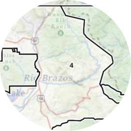
INFO: Mule Deer Hunting in New Mexico Unit 4

Although the later season rifle hunts carry the highest number in success rates, the early seasons still impress by maintaining an almost 50% average. The warm temperatures and scarce water sources propel early-season hunters’ success way up for still-hunting a water hole. Rifle seasons’ recipe for success is credited to the mild winter and increasing migratory deer traffic. Pre-season scouting is beneficial to learn the summer patterns of the deer. During the hottest temperatures, bucks bed down for the majority of the day, but when they arise to go hit the water hole, a knowledgeable hunter will be ready!
SUCCESS RATES for Mule Deer Hunting in New Mexico Unit 4
5 Year Estimated Average for Deer
Archery (RO) 45.00%
Rifle 1 (RO) 42.00%
Rifle 2 (RO) 40.00%
Rifle 1 80.00%
Rifle 1 (YO) 50.00%
Rifle 2 (YO) 80.00%
Mule Deer TROPHY QUALITY for Unit 4 New Mexico
Average Quality 130″ – 160″
Trophy Potential 170″+
Buck to Doe Ratio 23:100
New Mexico Unit 4 Mule Deer Hunting FORUM Coming Soon!

INFO: Elk Hunting in New Mexico Unit 4

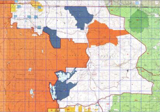
The low percentage of public land in Unit 4 can pose a hurdle depending on what season you draw. Hunting a low-elevation public area in the early season will be our top advice for success. However, if you are linked up with an outfitter that has access to hunting grounds of various elevations, your hunting trip’s success will not be driven by environmental factors alone. Fortunately, the public land available for hunting in Unit 4 is located in diverse locations with varying elevations and terrain. The mixed terrain creates an idealistic location for glassing bulls. The overlooking ridges offer a desirable vantage point for seeking herds in order to spot and stalk.
SUCCESS RATES for Elk Hunting in New Mexico Unit 4
5 Year Estimated Average for Elk
Archery 1 (Sargent – RO) 50.00%
Archery 1 (Humphries – RO) 30.00%
Archery 2 (Sargent – RO) 60.00%
Archery 2 (Humphries – RO) 20.00%
Rifle 1 (Humphries – RO) 70.00%
Rifle 1 (Sargent – RO) 88.00%
Rifle 2 (Humphries – RO) 55.00%
Rifle 2 (Sargent – RO) 75.00%
Rifle 3 (Sargent – RO) 60.00%
Rifle 4 (Sargent – RO) 70.00%
Elk TROPHY QUALITY for Unit 4 New Mexico
Average Quality 260″ – 300″
Trophy Potential 330″+
Bull to Cow Ratio 38:100
New Mexico Unit 4 Elk Hunting FORUM Coming Soon!

Available Hunts for New Mexico Unit 4

No Available Hunts

Unit 4 Hunting Information Video

iconinfo.png

Cities Near NM Unit 4

lay-of-the-land-icon-.gif

New Mexico Unit 4 Topo Map

Total Acreage: 445,000 acres over 695 square miles

Total Public Land: 84,000 acres or 18%

Land Ownership Mix: 82% Private; 18% Public; BLM: 3,840 acres; State: 63, 104 acres; Other Govt Owned: 35,840

Species: Elk, Mule Deer, Pronghorn, Sheep

Elevation Variances: 6,800 ft. to 11,000 ft.

Terrain Difficulty Overall: Mild to Moderate

Land Coverage/Vegetation: Land cover includes 33% shrub/scrub, 26% evergreen forest, 20% grassland/herbaceous and 10% deciduous forest

Unit 4 Boundaries: Beginning at the junction of the eastern boundary of the Jicarilla Apache Indian Reservation and the New Mexico-Colorado state line and running east along the state line to the eastern boundary of the Tierra Amarilla Grant, then south along the eastern boundary of the Tierra Amarilla Grant and west along its southern boundary to its junction with the eastern boundary of the Jicarilla Apache Indian Reservation, then north along the eastern boundary of the reservation to its junction with the New Mexico-Colorado state line.

map-icon.png

Lay of the Land in NM Unit 4

lay-of-the-land-icon-.gif

Terrain in GMU 4 NM

In addition to being classified as a warm unit, Unit 4 does contain areas of heavily forested mountain ranges. The higher altitudes will be more challenging to navigate and maneuver through, as opposed to the less rugged, arid terrain of the unit’s counterparts. In addition to the mountain ranges, Unit 4 contains a rather high density of farms and croplands. However, be sure to stay informed on public and private ownership of property since there is a higher concentration of private land than public land.
vegetation-icon.png

Vegetation in GMU Unit 4 NM

The upper elevations contain a mixed-coniferous blend of evergreen and deciduous forest, consisting of pinyon-juniper and ponderosa pine trees. The low and mid-elevations contain tracts of land populated by shrubbery or grassy varieties.
map-directions-icons.png

Access Points in NM GMU 4

Gaining access to the hunting areas of Unit 4 New Mexico, hunters have a large network of small roads and access trails to travel. If you are planning on driving a motorized vehicle on New Mexico public land, you must obtain a non-resident OHV (Off-Highway Vehicle) registration decal or purchase on through your home state. New Mexico permits are available for purchase at all New Mexico Department of Game and Fish offices and online. It is the responsibility of the forest visitor to obtain a Motor Vehicle Use Map (MVUM) to abide by the laws.