New Mexico Unit 12 Hunting Information

Home » Hunting Informations » New Mexico Units Hunting Information » New Mexico Unit 12 Hunting Information

Overview of NM GMU 12 Hunting Facts

Unit 12 borders the Arizona state line. It is also conventionally located north of the Gila Mountains. The land in unit 12 consists of private, state, BLM, and tribal land. This is one of the most sought out units in New Mexico. The state only issues a few tags each year which causes low hunting pressure. For more information check out the Info for Cities Near Unit 12 section on the right.

Table of Contents

Unit 12 Species Hunting Info

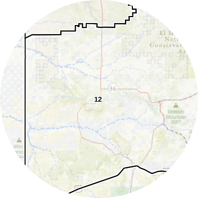
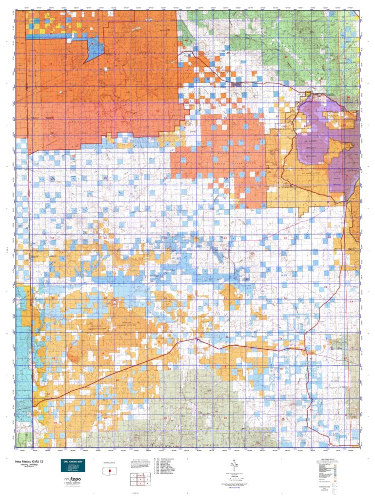
INFO: Elk Hunting in New Mexico Unit 12
During early archery seasons, bulls tend to only bugle in the evening, right before dark. They also go to sleep pretty soon after the sun comes up. Towards the end of the season is when the bulls will become more vocal. They will also start to move at later times in the mornings and at earlier times in the afternoons. By the time the later archery season comes around, bulls are a lot more vocal, giving you a better opportunity for a successful hunt. Be on the lookout for bulls near watering holes, and the foothills.

SUCCESS RATES for Elk Hunting in New Mexico Unit 12
5 Year Estimated Average for Elk
Archery 1 20.00%
Archery 2 30.00%
Archery 3 5.00%
Rifle 1 60.00%
Rifle 2 50.00%
Rifle 3 45.00%
Rifle 4 42.00%
Elk TROPHY QUALITY for Unit 12 New Mexico
Average Elk Quality 300″ – 330″
NM Area 12 Trophy Elk Potential 330″+
GMU 12 Bull to Cow Ratio 33:100
New Mexico Unit 12 Elk Hunting FORUM Coming Soon!]

No data found!

iconinfo.png

Cities Near NM Unit 12

lay-of-the-land-icon-.gif

New Mexico Unit 12 Topo Map

Total Acreage: 1,650,000 acres over 2,500 square miles

Total Public Land: 650,000 acres or 38%

Land Ownership Mix: 62% Private; 38% Public; BLM: 348,800 acres; State: 298,368 acres; Other Govt Owned: 147,328 acres

Species: Elk, Mule Deer, Pronghorn, Sheep

Elevation Variances: 6,200 ft. to 8,500 ft.

Terrain Difficulty Overall: Mild to Moderate

Land Coverage/Vegetation: Land cover includes 58% shrub/scrub, 23% evergreen forest and 18% grassland/herbaceous

map-icon.png

Lay of the Land in NM Unit 12

lay-of-the-land-icon-.gif

Terrain in GMU 12 NM

Although Unit 12 does not have many mountain peaks, there are a few here and there. This unit consists of mostly mesas, canyons, and large basins. Throughout this unit, you will find the Tamah Navajo Indian Reservation, BLM Land, the El Malpais National Conservation Area, Mestia Blanca, and the Eagle Peak Wilderness.
vegetation-icon.png

Vegetation in GMU Unit 12 NM

The elevations in unit 12 range from 7,000 ft to 8,500 ft. There is a good mixture of vegetation in this unit including junipers, sagebrush, oak brush, pines, willows, tamarisk, and cottonwoods.
map-directions-icons.png

Access Points in NM GMU 12

Unit 12 has well-maintained gravel and dirt roads which provide good access for hunters. There are two main roads that run through this unit including State Route 601 and State Road 117. State Route 601 provides the best access to the public land. Four-wheel-drive vehicles are recommended when traveling back and forth on the roads. When available, ATVs are recommended for off-road traveling. Having a map that shows public and private boundaries is extremely helpful while off in the woods.