New Mexico Unit 9 Hunting Information

Home » Hunting Informations » New Mexico Units Hunting Information » New Mexico Unit 9 Hunting Information

Overview of NM GMU 9 Hunting Facts

Game Management Unit 9 in western New Mexico spans the three counties of Socorro, Valencia and Cibola and maintains its reputation as a premier trophy elk hunting destination. Unit 13 may contain more private land than public, but its total size of nearly three million acres means that there is plenty of hunting space to go around! For more New Mexico Unit 9 hunting information, check out the Info for Cities Near Unit 9 section on the right.

Table of Contents

NM Unit 9 Species Hunting Info

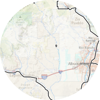
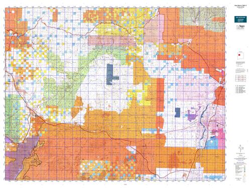
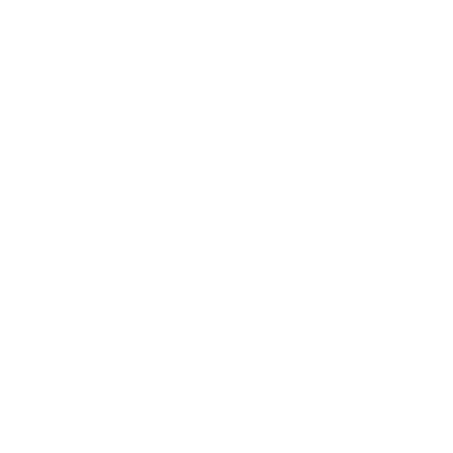
INFO: Mule Deer Hunting in New Mexico Unit 9
Glass rough canyons off mesas to find big tracks within 100 yards and hunt the canyons below. Focus on cover in rugged, rocky terrain within a mile of water. With the archery season, glass open terrain at first and last light. Bucks are still in velvet during this hunt. Most bucks are in bachelor groups near water. Stand-hunting at a stock tank can work, but the bigger bucks usually avoid watering until after dark. Be prepared to go days without seeing a decent buck. Combined with the fact that deer numbers are low, the timing of the muzzleloader and rifle season makes for difficult hunting. Glass the shady sides of canyons, hills or mesas.

SUCCESS RATES for Mule Deer Hunting in New Mexico Unit 9
5 Year Estimated Average for Deer
Archery 20.00%
Muzzleloader 25.00%
Rifle 30.00%
Rifle (Youth Only) 22.00%

Mule Deer TROPHY QUALITY for Unit 9 New Mexico
Average Deer Quality 140″ – 160″
Trophy Deer Potential 160″+
New Mexico Unit 9 Mule Deer Hunting FORUM Coming Soon!

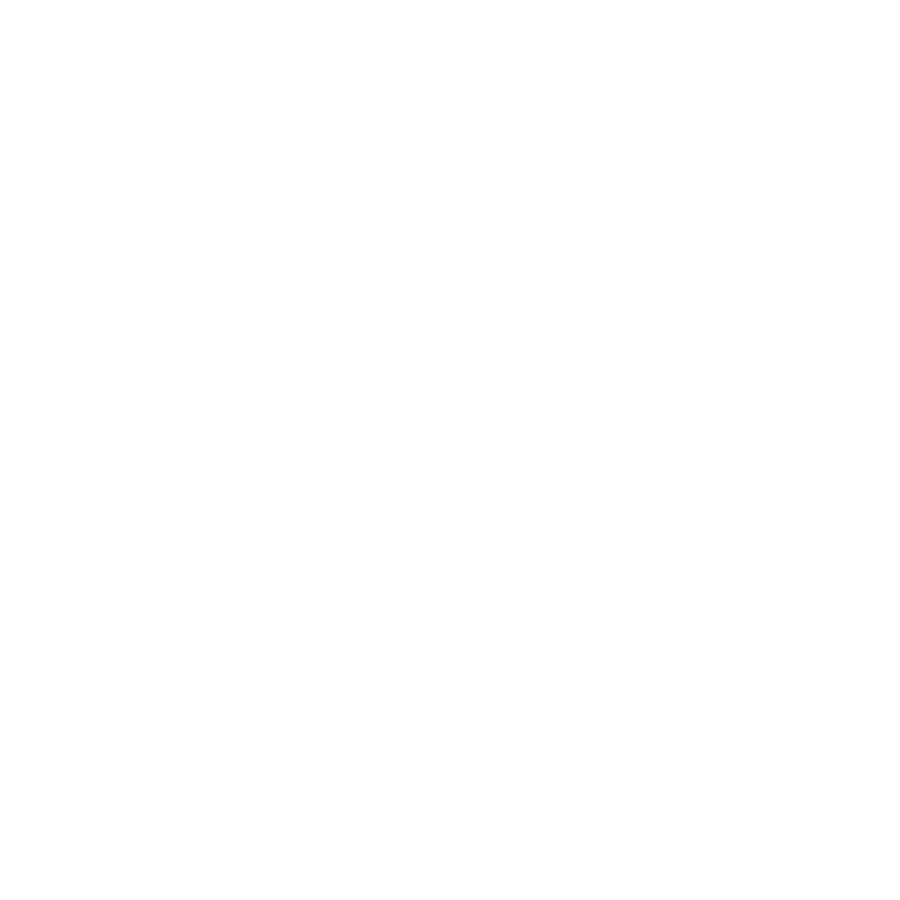
INFO: Elk Hunting in New Mexico Unit 9
Even though this unit doesn’t look like classic elk habitat, hunters can find bulls almost anywhere, grass, water and timbered or high brush are nearby. Good areas include Mount Taylor, mesas to the northwest and rough terrain to the northeast. Only residents can hunt in Marquez State Wildlife Area, and they must draw tags that are valid only in Marquez. The desert canyons bordering Floyd Lee Ranch are occasionally good. Stand hunting over water holes is effective in dry weather. Distances can be deceptive in dry and clear air. Glass for tiny tan specks, not extremely large animals.

SUCCESS RATES for Elk Hunting in New Mexico Unit 9
5 Year Estimated Average for Elk
Archery 1 10.00%
Archery 2 8.00%
Muzzleloader 1 15.00%
Muzzleloader 2 10.00%
Muzzleloader 3 20.00%

Elk TROPHY QUALITY for Unit 9 New Mexico
Average Elk Quality 270″ – 300″
NM Area 9 Trophy Elk Potential 300″+
GMU 9 Bull to Cow Ratio 25:100
New Mexico Unit 9 Elk Hunting FORUM Coming Soon!

INFO: Antelope Hunting in New Mexico Unit 9
Very few antelope can be found in this area and the hunting can be difficult. During the seasons, stand hunting over a stock tank or water trough can be effective. Watch for windmills. A good place to set up a ground blind during the bow hunt is along a fence as antelope tend to walk fence lines for long distances before they cross.

SUCCESS RATES for Antelope Hunting in New Mexico Unit 9
5 Year Estimated Average for Antelope
Archery 55.00%
Rifle 75.00%

Antelope TROPHY QUALITY for Unit 9 New Mexico
Average Antelope Size 60″ – 70″
Trophy Antelope Potential 70″+
New Mexico Unit 9 Antelope Hunting FORUM Coming Soon!

Available Hunts for New Mexico Unit 9

Unit 9 Hunting Information Video

lay-of-the-land-icon-.gif

New Mexico Unit 9 Topo Map

Total Acreage: 2,131,000 acres over 3,329 square miles

Total Public Land: 553,000 acres or 25%

Land Ownership Mix: 75% Private; 25% Public; US Forest Service: 185,408 acres; BLM: 227,072 acres; State: 107,328 acres; Other Govt Owned: 593,408 acres

Species: Elk, Mule Deer, Pronghorn, Sheep

Elevation Variances: 5,000 ft. to 11,000 ft.

Terrain Difficulty Overall: Mild to Moderate

Land Coverage/Vegetation: Land cover includes 53% shrub/scrub, 25% grassland/herbaceous and 16% evergreen forest

Unit 9 Boundaries: Beginning at Prewitt at the junction of I-40 and CR 19 (the road to Hospah) and running north along the CR 19 to its intersection with Inditos draw, then south and east down Inditos draw to its junction with Voght draw, then east down Voght draw to its junction with arroyo Chico, then east down arroyo Chico to its intersection with the BLM road 1103 (the San Luis road, leading from Cabezon to US 550), then northeast along BLM road 1103/San Luis road to its intersection with the west boundary of the Jemez Indian reservation, then south and east along the Jemez reservation boundary to the boundary of the Zia Indian reservation, then south, east, and north along the Zia reservation boundary to its intersection with US 550 west of San Ysidro, then east and southeast along US 550 to its junction with I-25 at Bernalillo, then south along I-25 to its junction with New Mexico Highway 6 at Los Lunas, then west and northwest along New Mexico 6 to its junction with I-40, then west along I-40 to Prewitt.

map-icon.png

Lay of the Land in NM Unit 9

lay-of-the-land-icon-.gif

Terrain in GMU 9 NM

An imposing volcanic cone that is visible up to 100 miles away, Mount Taylor, is the highest peak in the Cibola National Forest and part of the San Mateo Mountains. It is a rugged and steep mountain that is challenging when covering ground on foot. It is surrounded by desert mesas, foothills and flats that are almost exclusively contained within private and tribal land.
vegetation-icon.png

Vegetation in GMU Unit 9 NM

Low elevations are mainly flat, desert grasslands with some brush and the occasional cottonwood tree along dry creek beds. Middle elevations consist of gently rolling foothills covered with grass, sagebrush, oakbrush, pinyon/juniper, rising to mesas above cliffs or slopes with ponderosa. High elevations consisting of Mesa tops are mainly pinyon/juniper, sage, oakbrush and ponderosa. Mount Taylor has aspens, firs, ponderosa and grassy meadows with steep slopes up high. The vegetation is very dense in the higher elevations with significant deadfall and ground level vegetation -visibility is very limited as a result and glassing for wildlife can be challenging at higher elevations. The lower areas of Mount Taylor are dense pinyon/juniper, ponderosa and oak brush.
map-directions-icons.png

Access Points in NM GMU 9

Public roads access most of the Forest Service and BLM land in the unit including Mount Taylor, the major mesas and BLM property northeast of Mount Taylor. Most state land is landlocked by private ground. Mount Taylor is covered in Forest Service roads and old mining roads that provide access for any hunter in an off-road vehicle. Backpacking in is not necessary in this unit, as there are few areas that offer seclusion from the available roads. Most public land within one mile of a public road. Four-wheel-drive recommended.