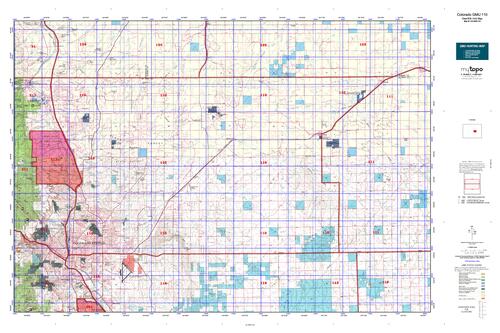
Colorado unit 110 hunting topo map to plan your successful hunt. Includes private and public land boundaries, roads and topography.
Description
Click Here to View Large Map or to Purchase
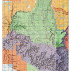
Colorado Unit 110 Hunting Topo Map with Printed Boundaries
Hunters Domain has Colorado Unit 110 hunt area maps that are 1:100,000-scale maps using Bureau of Land Management land status base maps.
Our UNIT 110 maps include:
Colorado public land ownership boundaries
Topographical contour lines
1:100,000 scale for easy viewing
Roads printed
Key terrain features to help you plan your hunt or trip
Hunt area or game management unit 110 (GMU 110) boundary is overlaid on the BLM base map
Easy planning for your upcoming big game hunt by defining roads and routes into the preferred area
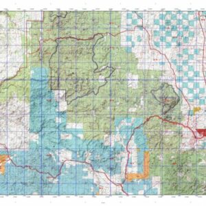
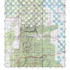
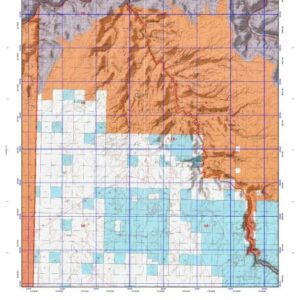
Custom maps for Unit 110 are also available (See it all on one map):
Color aerial photo maps: high resolution (you define borders/boundaries)
TOPO maps only where you easily define borders or edges of maps with our online program
Hybrid maps: a unique and detailed aerial photo combined with a USGS topographical maps (user-defined boundaries)
Order your Colorado Unit 110 Map Today!
The actual boundary description/definitions printed below from Colorado Parks and Wildlife hunting regulations brochure could have errors or been amended by the state so always check in their most current printed regulations or the Colorado Parks and Wildlife website to verify these boundaries before hunting as these are for reference only.
Colorado Big Game Unit 110
– Unit 110 Topo/Map Colorado – Game Management Unit (GMU-110).
Game Management Unit (GMU)
BLM Maps:
Reservation Land
US Forest Service Maps:
Reservation land
Click Here to Order Your Color Colorado Unit 110 Hunting Map
Colorado Unit 110 Description
Unit 110 Located in El Paso County bounded on the North by Douglas-Elbert-El Paso Corado lines; on the East by U.S. 24 and CR 523 (Calhan Hwy.); on the South by Colorado 94; on the West by I-25.
GMU 110 Elevation: 5,971 to 7,686 feet. Terrain: Flat to gently rolling, steeper with bluffs to the north. Vegetation: Primarily shortgrass prairie. Northern portion has ponderosa pine and montane shrub land. Weather: First freeze or snow possible mid-Sept. Land status: 99 percent private. Hunter Access: Fair to poor; better in east half. Western portion of the unit is urban/suburban with small to medium sized ranches. Larger sized private ranches in the eastern half of the unit.