Colorado unit 112 hunting topo map to plan your successful hunt. Includes private and public land boundaries, roads and topography.
Description
Click Here to View Large Map or to Purchase
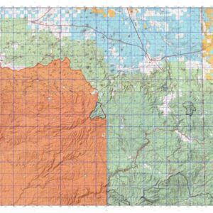
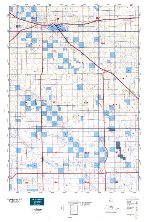
Colorado Unit 112 Hunting Topo Map with Printed Boundaries
Hunters Domain has Colorado Unit 112 hunt area maps that are 1:100,000-scale maps using Bureau of Land Management land status base maps.
Our UNIT 112 maps include:
Colorado public land ownership boundaries
Topographical contour lines
1:100,000 scale for easy viewing
Roads printed
Key terrain features to help you plan your hunt or trip
Hunt area or game management unit 112 (GMU 112) boundary is overlaid on the BLM base map
Easy planning for your upcoming big game hunt by defining roads and routes into the preferred area
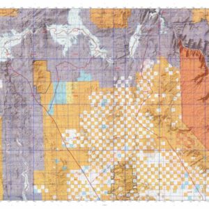
Custom maps for Unit 112 are also available (See it all on one map):
Color aerial photo maps: high resolution (you define borders/boundaries)
TOPO maps only where you easily define borders or edges of maps with our online program
Hybrid maps: a unique and detailed aerial photo combined with a USGS topographical maps (user-defined boundaries)
Order your Colorado Unit 112 Map Today!
The actual boundary description/definitions printed below from Colorado Parks and Wildlife hunting regulations brochure could have errors or been amended by the state so always check in their most current printed regulations or the Colorado Parks and Wildlife website to verify these boundaries before hunting as these are for reference only.
Colorado Big Game Unit 112
– Unit 112 Topo/Map Colorado – Game Management Unit (GMU-112).
Game Management Unit (GMU)
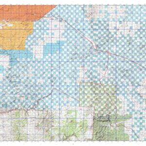
BLM Maps:
Reservation Land
US Forest Service Maps:
Reservation land
Click Here to Order Your Color Colorado Unit 112 Hunting Map
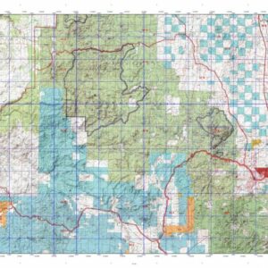
Colorado Unit 112 Description
Unit 112 Located in Lincoln County bounded on the North by U.S. 40; on the East by Colorado Primary 109; on the South by Colorado 94; on the West by Colorado Hwy 71.
GMU 112 Elevation: 5,336 to 5,070 feet. Terrain: Is mostly level to gently rolling hills. Vegetation: Short-grass prairie with interspersed agricultural crops. There is limited cottonwood riparian. Weather: Mild and dry. First freeze or snow may occur in mid-Oct. to mid-Nov. Land Status: 100 percent private. Hunter Access: Good for pronghorn; but only fair for deer. Deer: Some deer herds growing. Look for brushy, weedy draws near croplands or in fallow fields. Mule deer and white tail deer found in various locations along Big Sandy Creek, primarily near alfalfa fields, cropland and open water. Rush Creek drainage offers hunting for white tail and mule deer. Pronghorn: Pronghorn found throughout the unit. Start looking around winter wheat fields. Small Game: Waterfowl (mostly teal) found early in the season. Cottontail rabbits and jackrabbits throughout the unit. Mourning dove found in early season near sunflower stands, cottonwood trees, and open water.