Colorado unit 49 hunting topo map to plan your successful hunt. Includes private and public land boundaries, roads and topography.
Description
Click Here to View Large Map or to Purchase
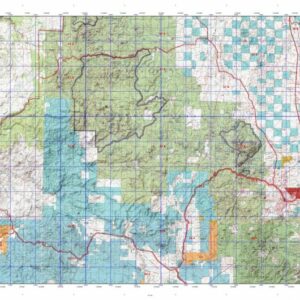
Colorado Unit 49 Hunting Topo Map with Printed Boundaries
Hunters Domain has Colorado Unit 49 hunt area maps that are 1:100,000-scale maps using Bureau of Land Management land status base maps.
Our UNIT 49 maps include:
Colorado public land ownership boundaries
Topographical contour lines
1:100,000 scale for easy viewing
Roads printed
Key terrain features to help you plan your hunt or trip
Hunt area or game management unit 49 (GMU 49) boundary is overlaid on the BLM base map
Easy planning for your upcoming big game hunt by defining roads and routes into the preferred area
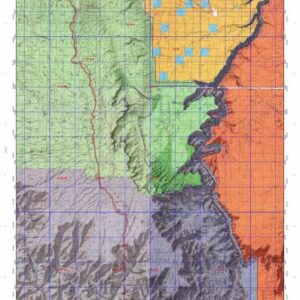
Custom maps for Unit 49 are also available (See it all on one map):
Color aerial photo maps: high resolution (you define borders/boundaries)
TOPO maps only where you easily define borders or edges of maps with our online program
Hybrid maps: a unique and detailed aerial photo combined with a USGS topographical maps (user-defined boundaries)
Order your Colorado Unit 49 Map Today!
The actual boundary description/definitions printed below from Colorado Parks and Wildlife hunting regulations brochure could have errors or been amended by the state so always check in their most current printed regulations or the Colorado Parks and Wildlife website to verify these boundaries before hunting as these are for reference only.
Colorado Big Game Unit 49
– Unit 49 Topo/Map Colorado – Game Management Unit (GMU-49).
Game Management Unit (GMU)
BLM Maps:
Reservation Land
US Forest Service Maps:
Reservation land
Click Here to Order Your Color Colorado Unit 49 Hunting Map
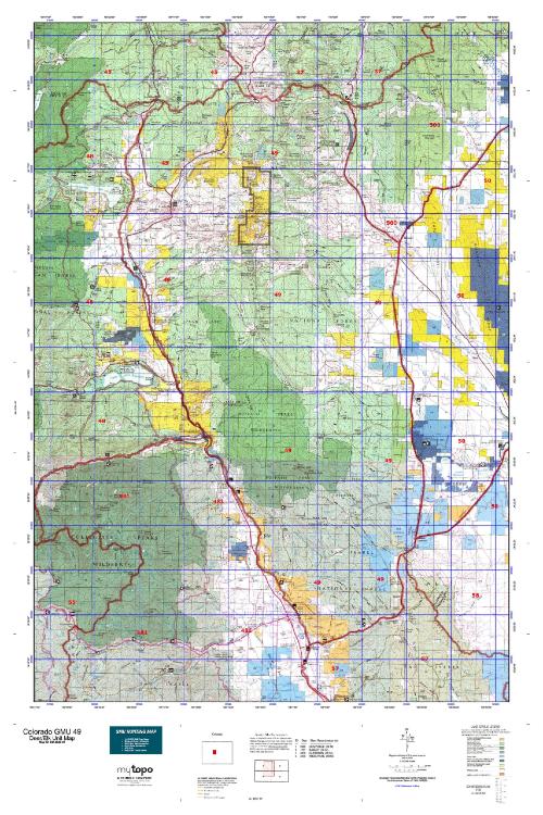
Colorado Unit 49 Description
Unit 49 Located in Lake, Chaffee and Park Counties bounded on the North by the Continental Divide; on the East by Colorado 9 and U.S. 285; on the South by U.S. 24; on the West by Arkansas River and Tennessee Creek.
GMU 49 Elevation: From 14,238-foot Mt. Cameron to 7,874 near Johnson Village. Terrain: Broad valley bottoms up to moderately steep hills, climbing to steep mountains. Vegetation: Piñons & junipers, aspens & pine, spruce & fir, alpine with grassy meadows. Weather: Extremely variable; first freeze or snow may be in early September.
Land Status: Approximately 80 percent public. Hunter Access: Good. Many public roads and trails to and through public lands. No motorized vehicles allowed in the Wilderness portion. Deer: Better areas are in the piñons and junipers in the Chaffee County portion of the unit. Paddock State Wildlife Area provides good hunting in later seasons. Weston Pass is a good access road to public National Forest Land. Elk: Most are on the Fairplay side of the mountain range. Herds are increasing near Leadville. Weston Pass is a good area to hunt because it is in between summer and wintering grounds. The national forest area around Leadville is worth checking out as well.