Colorado unit 62 hunting topo map to plan your successful hunt. Includes private and public land boundaries, roads and topography.
Description
Click Here to View Large Map or to Purchase
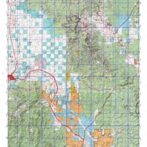
Colorado Unit 62 Hunting Topo Map with Printed Boundaries
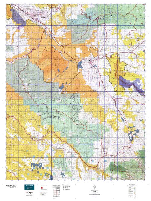
Hunters Domain has Colorado Unit 62 hunt area maps that are 1:100,000-scale maps using Bureau of Land Management land status base maps.
Our UNIT 62 maps include:
Colorado public land ownership boundaries
Topographical contour lines
1:100,000 scale for easy viewing
Roads printed
Key terrain features to help you plan your hunt or trip
Hunt area or game management unit 62 (GMU 62) boundary is overlaid on the BLM base map
Easy planning for your upcoming big game hunt by defining roads and routes into the preferred area
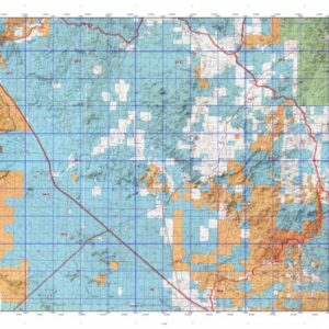
Custom maps for Unit 62 are also available (See it all on one map):
Color aerial photo maps: high resolution (you define borders/boundaries)
TOPO maps only where you easily define borders or edges of maps with our online program
Hybrid maps: a unique and detailed aerial photo combined with a USGS topographical maps (user-defined boundaries)
Order your Colorado Unit 62 Map Today!
The actual boundary description/definitions printed below from Colorado Parks and Wildlife hunting regulations brochure could have errors or been amended by the state so always check in their most current printed regulations or the Colorado Parks and Wildlife website to verify these boundaries before hunting as these are for reference only.
Colorado Big Game Unit 62
– Unit 62 Topo/Map Colorado – Game Management Unit (GMU-62).
Game Management Unit (GMU)
BLM Maps:
Reservation Land
US Forest Service Maps:
Reservation land
Click Here to Order Your Colorado Unit 62 Topo Map
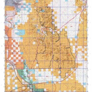
Colorado Unit 62 Description
Unit 62 Uncompahgre Plateau Region: Delta, Mesa, Montrose and Ouray Counties bounded on the North by Colorado Hwy 141; on the East by Colorado Hwy 50 & 550; on the South by Colorado Hwy 62; on the West by Dave Wood Rd. and USFS 402 (Divide Rd.).
The plateau encompasses 2,300 square miles of terrain that includes large, relatively flat mesas bisected by deep, rugged canyons. The elevation ranges from 4,600 feet to 10,300 feet. Be prepared for unpredictable weather changes.
Numerous roads provide easy access to the plateau, but many canyons are accessible only by foot or horseback. Bow
hunters and muzzleloaders should concentrate on U.S. Forest Service lands along the top of the plateau. The highest
success rate for bull hunters occurs in GMU 62 during first season. License reductions in GMU 62 the last few years have decreased hunting pressure significantly. Overall, this unit provides hunters a wide variety of terrain and good
opportunity.