Colorado unit 861 hunting topo map to plan your successful hunt. Includes private and public land boundaries, roads and topography.
Description
Click Here to View Large Map or to Purchase
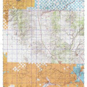
Colorado Unit 861 Hunting Topo Map with Printed Boundaries
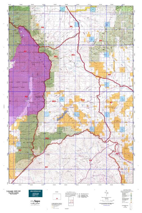
Hunters Domain has Colorado Unit 861 hunt area maps that are 1:100,000-scale maps using Bureau of Land Management land status base maps.
Our UNIT 861 maps include:
Colorado public land ownership boundaries
Topographical contour lines
1:100,000 scale for easy viewing
Roads printed
Key terrain features to help you plan your hunt or trip
Hunt area or game management unit 861 (GMU 861) boundary is overlaid on the BLM base map
Easy planning for your upcoming big game hunt by defining roads and routes into the preferred area
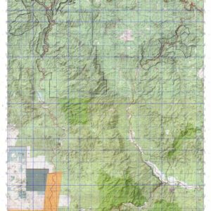
Custom maps for Unit 861 are also available (See it all on one map):
Color aerial photo maps: high resolution (you define borders/boundaries)
TOPO maps only where you easily define borders or edges of maps with our online program
Hybrid maps: a unique and detailed aerial photo combined with a USGS topographical maps (user-defined boundaries)
Order your Colorado Unit 861 Map Today!
The actual boundary description/definitions printed below from Colorado Parks and Wildlife hunting regulations brochure could have errors or been amended by the state so always check in their most current printed regulations or the Colorado Parks and Wildlife website to verify these boundaries before hunting as these are for reference only.
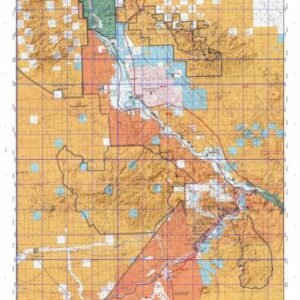
Colorado Big Game Unit 861
– Unit 861 Topo/Map Colorado – Game Management Unit (GMU-861).
Game Management Unit (GMU)
BLM Maps:
Reservation Land
US Forest Service Maps:
Reservation land
Click Here to Order Your Color Colorado Unit 861 Hunting Map
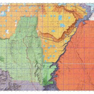
Colorado Unit 861 Description
Unit 861 Located in Huerfano County bounded on the North by Custer-Huerfano County line; on the East by Colorado 69, CRs 555 (Muddy Creek Rd.), 570 & 572 (Pass Creek Rd.); on South and the West by Sangre de Cristo divide.
GMU 861 Elevation: 6,966 feet near Gardner to 14,048 at Ellingwood Point. Terrain: Flat to gently rolling valley bottom climbing quickly to steep, rough mountains. Vegetation: Grass to pine to spruce, firs and aspens to alpine meadows. Weather: Variable, but first snow or freeze can occur mid-Sept. Land Status: Approximately 30 percent public. Hunter Access: Fair to good access for public lands. Fair to poor on private lands. Deer: Deer found throughout the unit. Deer move into lower areas during heavy snows. Elk: SW of Bradford and the northern slopes of Slide Mountain in the early seasons. Pronghorn: Gardner to West of Sharpsdale and north to Bradford. Heavy winters drive the animals onto private land. Concentrate on BLM tracks (if access allows) North and
West of Malachite.