Description
Click Here to View Large Map or Order
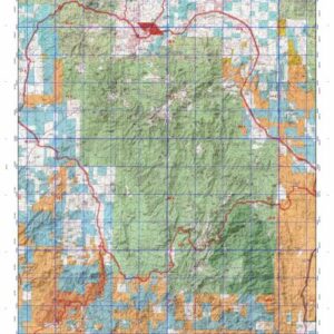
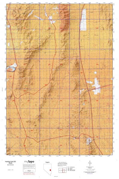
Nevada Unit 222 hunting map topo with printed boundaries
HuntersDomain has Nevada unit 222 hunt area maps that are 1:100,000-scale maps using Bureau of Land Management land status base maps.
Our UNIT 222 maps include:
- Nevada public land ownership boundaries
- Topographical contour lines
- 1:100,000 scale for easy viewing
- Roads printed
- Key terrain features to help you plan your hunt or trip
- Hunt area or game management unit 222 (GMU 222) boundary is overlaid on the BLM base map
- Easy planning for your upcoming big game hunt by defining roads and routes into the preferred area
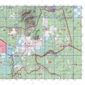
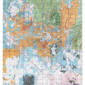
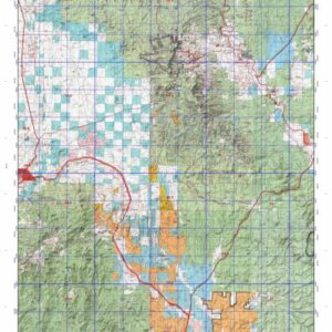
Custom maps for unit 222 are also available (See it all on one map):
- Color aerial photo maps: high resolution (you define borders/boundaries)
- TOPO maps only where you easily define borders or edges of maps with our online program
- Hybrid maps: a unique and detailed aerial photo combined with a USGS topographical maps (user-defined boundaries)
Order your unit 222 Nevada topo map today!
The actual boundary description/definitions printed below from the Nevada Division of Wildlife hunting regulations brochure could have errors or been amended by the state so always check in their most current printed regulations or the Nevada Division of Wildlife website to verify these boundaries before hunting as these are for reference only.
– Unit 222 Topo/Map Nevada – Game Management Unit (GMU-222).
Game Management Unit (GMU)
BLM Maps:
Reservation Land
US Forest Service Maps:
Reservation land
Click Here to Order Unit 222 Topo Map
Unit description
Unit 222: Those portions of White Pine, Lincoln and Nye’s counties bounded on the north by U.S. Highway No. 50/6/93, on the east by U.S. Highway No. 93, on the south by the Bristol Pass Road, and on the west by State Route No. 318 and the Cave Valley Road. Units 221 and 222 each contain a newly designated Wilderness Area, and unit 221 has a second previously existing area. Mount Grafton (78,754 acres) and the South Egan Range (67,214 acres) Wilderness Areas are both managed by the BLM. No motorized vehicles are allowed within Wilderness Areas, except on designated roads and trails. For more information visit or call the Ely BLM Office (775) 289-1800.