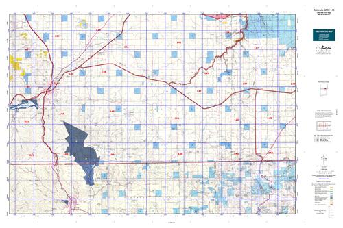
Colorado unit 140 hunting topo map to plan your successful hunt. Includes private and public land boundaries, roads and topography.
Description
Click Here to View Large Map or to Purchase
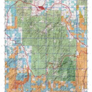
Colorado Unit 140 Hunting Topo Map with Printed Boundaries
Hunters Domain has Colorado Unit 140 hunt area maps that are 1:100,000-scale maps using Bureau of Land Management land status base maps.
Our UNIT 140 maps include:
Colorado public land ownership boundaries
Topographical contour lines
1:100,000 scale for easy viewing
Roads printed
Key terrain features to help you plan your hunt or trip
Hunt area or game management unit 140 (GMU 140) boundary is overlaid on the BLM base map
Easy planning for your upcoming big game hunt by defining roads and routes into the preferred area
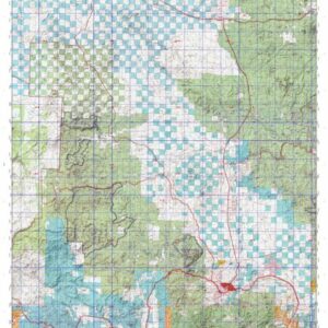
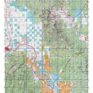
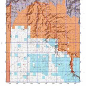
Custom maps for Unit 140 are also available (See it all on one map):
Color aerial photo maps: high resolution (you define borders/boundaries)
TOPO maps only where you easily define borders or edges of maps with our online program
Hybrid maps: a unique and detailed aerial photo combined with a USGS topographical maps (user-defined boundaries)
Order your Colorado Unit 140 Map Today!
The actual boundary description/definitions printed below from Colorado Parks and Wildlife hunting regulations brochure could have errors or been amended by the state so always check in their most current printed regulations or the Colorado Parks and Wildlife website to verify these boundaries before hunting as these are for reference only.
Colorado Big Game Unit 140
– Unit 140 Topo/Map Colorado – Game Management Unit (GMU-140).
Game Management Unit (GMU)
BLM Maps:
Reservation Land
US Forest Service Maps:
Reservation land
Click Here to Order Your Color Colorado Unit 140 Hunting Map
Colorado Unit 140 Description
Unit 140 Located in Las Animas County bounded on the North by U.S. 160; on the East by Colorado 389; on the South by NM; on the West by I-25.
GMU 140 Elevation: 9,544 to 5,414 feet. Terrain: Gently rolling; changing rapidly to steep canyons and mesas.
Vegetation: Shortgrass prairie, pinon-pine, oak , spruce and fir. Weather: Variable with first freeze possible early October. Land Status: Approximately 99 percent private. Hunter access: Poor to average for deer, elk, and pronghorn. Landowner permission required before making application for pronghorn limited licenses. Elk: Foothills and mesas in south half of unit. Deer: Foothills and mesas in south half of unit. Pronghorn: Throughout the grassland areas in the north and east portions of the unit.